

· AFX Research
Access Control Along a Highway, and What the Record Shows
Highway access rights sold or condemned away, frontage roads, plat notes that bar direct driveways, and how a records search establishes whether a parcel can reach the road at all.
Table of Contents
A parcel can have six hundred feet of highway frontage and no legal right to drive onto the highway. That sounds like a contradiction and it is routine. When a state widened a road, it frequently bought or condemned the abutting owners’ right of access along a defined line, leaving the frontage in private hands while closing it to traffic. The instrument that did it is often fifty years old, indexed under an owner nobody in the current chain recognizes, and entirely decisive about what the lot can become.
Frontage and the right to use it
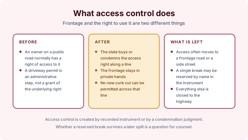
An owner on a public road normally holds a right of access to it, an incident of ownership separate from the land itself. A driveway permit is an administrative step layered on top of that right, not a grant of it. Access control takes the underlying right away.
After a taking, the frontage stays in private ownership and no new curb cut can be permitted across the controlled line. Access typically moves to a frontage road, a service drive, or a side street. Sometimes a single break is reserved by name in the instrument, and that reservation becomes the only way in.
Where the restriction was recorded
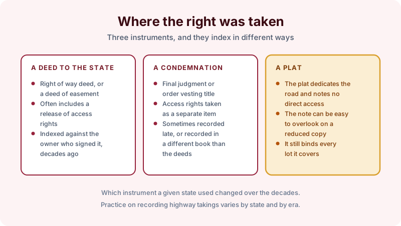
A deed to the state. A right of way deed or a deed of easement, often carrying a release of access rights in the granting clause. It indexes against whoever owned the land at the time, which may be three or four conveyances back.
A condemnation. A final judgment or order vesting title, with the access rights taken as a separate item of compensation. These are sometimes recorded late, and in some counties they land in a different series of books than the deeds.
A plat. The subdivision plat dedicates the road and carries a note that no direct access is permitted. The note is easy to miss on a reduced copy and it binds every lot the plat covers.
Which instrument a state used changed over the decades, and practice on recording highway takings varies by state and by era. Never assume that the form used in one county describes the one next door. Our process is to search the full chain rather than the current deed for exactly this reason.
Why it bites on a split or a change of use
Two situations turn this from a historical curiosity into a live problem. The first is a lot split. Divide a controlled parcel and one of the new lots can land entirely behind the control line with no frontage of its own and no permitted break. The second is a change of use. A field that only ever needed a farm gate becomes a site that needs a commercial entrance, and the entrance cannot be permitted.
Lenders on commercial sites ask about this directly, which is why the question is usually settled alongside the rest of the easement search rather than after the appraisal.
What a search can establish
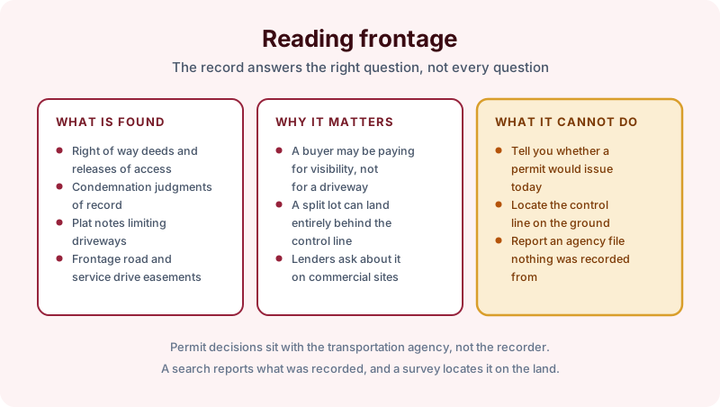
The search reports the right of way deeds, releases of access, condemnation judgments, plat notes, and frontage road or service drive easements found of record against the parcel over the term searched, with copies of the instruments. What it cannot do is tell you whether a permit would issue today, locate the control line on the ground, or report an agency determination that nothing was recorded from. Permit decisions sit with the transportation agency, not the recorder. As with paper streets and rights of way never built, nothing found is not proof of free access.
The takeaway
Treat frontage and access as separate facts. Search the full chain rather than the current owner, read any plat note in the original rather than a reduced copy, and ask the transportation agency about permits once the recorded picture is clear. Reports come back in 2 to 3 business days.
Start the order online, or send us the address and the county and we will tell you which search term fits and what it would and would not cover before anything is ordered.