

· AFX Research
Lake and Waterfront Access Easements: What Gets Recorded
How back lots get to the water, why the plat matters as much as the deeds, and what the record can and cannot settle about docks, paths, and who may use them.
Table of Contents
Lake access is the most contested easement subject there is, and the reason is arithmetic. A subdivision platted in the 1920s put a dozen lots on the shoreline and sixty behind them, promised the back lots access to the water through a described strip, and left the specifics to language nobody expected to be read a century later. Now the strip is worth more than the lots, and everyone has a different memory of the arrangement. Like any right of way, the answer is in the instruments, and here the instruments are unusually old.
Three ways to reach the water
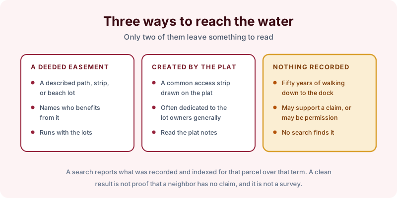
A deeded easement is the cleanest case. An instrument describes a path, a strip, or a designated beach lot, names the parcels that benefit, and runs with those lots to whoever owns them next.
A plat dedication is more common in lake country, and it works differently. The recorded subdivision map shows an access strip or a park parcel, and the notes on the plat allocate its use, often to the lot owners generally rather than to named lots. That makes reading the plat itself unavoidable, in the same way that easements created by a subdivision plat drive so many other disputes.
Nothing recorded is the third and messiest possibility. Three generations have walked down to the dock, and no instrument anywhere describes the right. That use may support a prescriptive claim, or it may have been neighborly permission all along, and no records search can tell you which.
Two questions decide most disputes
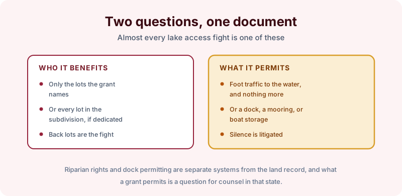
The first is who benefits. If the grant names lots 14 through 19, the owner of lot 40 is not on the list, however long the family has been using the path. If instead the plat dedicated the strip to all lot owners in the subdivision, the shoreline owners have sixty neighbors with a right to cross.
The second is what is permitted. Foot traffic to the water is one thing. A dock, a boat lift, a mooring, or trailer storage is another, and older grants frequently say nothing at all about any of it. That silence is where litigation lives, because the document was written when a canoe was the whole question.
Two adjacent systems are worth naming so they do not get confused with the land record. Riparian and littoral rights are creatures of state law rather than of any recorded instrument, and dock permitting usually sits with a state agency or a lake district. A search finds the recorded grant; what it permits is a question for counsel in that state.
Scoping the search
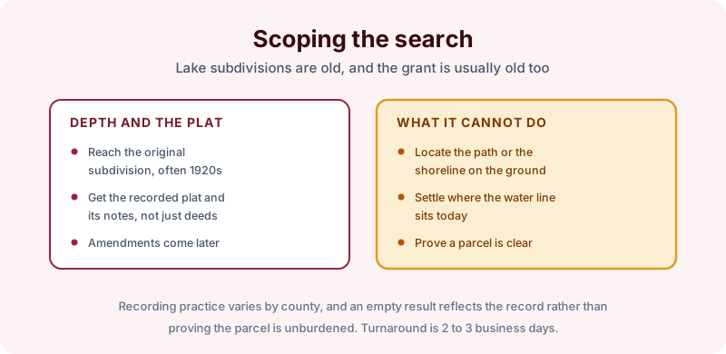
Depth first. If the subdivision was platted in 1924, a short search will never reach the instrument that created the access, which is why the three search terms exist. Ask specifically for the recorded plat and its notes alongside the deeds, and expect amendments, since these subdivisions have often adopted restrictions or reallocated the common areas somewhere along the way.
Read the report for what it is. It sets out the instruments recorded and indexed for that parcel over that term, as of the search date, with copies attached so the wording can be read rather than paraphrased. Recording practice varies by county, an empty result is not proof the parcel is unburdened or that no neighbor has a claim, and a search is not a survey: it cannot locate the path on the ground or tell you where the water line sits today, which on a lake moves. Turnaround is 2 to 3 business days.
The takeaway
Get the plat, get the grant, and read who is named and what is allowed before you buy, build, fence, or put in a dock. On waterfront property those two documents are worth more than any assurance about how things have always been done. Start the order online, or send us the address and the county and we will tell you which search term fits and what it would and would not cover before anything is ordered.